Founders Preserve
Founders Preserve
Town: Ledyard
Maintained Uses: walking, hiking, mountain biking, equestrian, bow hunting (by ordinance/permit in season)
Difficulty: moderate
Type: Arterial farm road
Surface: packed earth/dirt
Pets: permitted (dogs on leash)
Year Preserved: 2025
Founders Tract: 93.14 acres
Edgerton Tract: 5.24 acres
Lat.: 41.39928830264474″N
Long.: -71.992792733439941″W
Trail Description
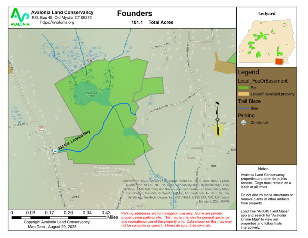
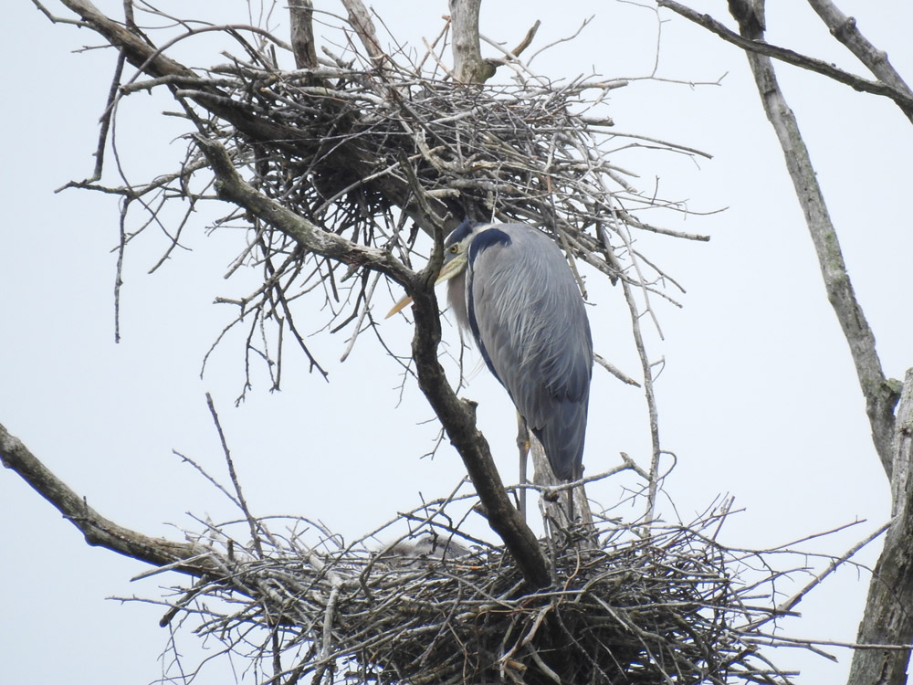
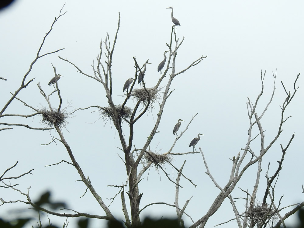
Avalonia Land Conservancy, Inc. has received an important former mill pond and surrounding habitat of wetland and mature growth forest in a transfer from the Town of Ledyard. The large greenway parcel had been slated for a development that was not completed and was foreclosed on by the Town. The Preserve, with wetlands that host nesting birds, will provide excellent opportunities for passive recreation and wildlife protection and viewing and is included in the Ledyard bow-hunting ordinance properties.
Since this exceptional parcel was foreclosed on for back taxes by the Town of Ledyard, it has been a top priority for conservation by Avalonia. In accordance with deed provisions from the Town of Ledyard will allow for the continued deer bow hunting per Town ordinance in season, and for the protection of historic features on the site as well as protection of the nesting wading birds noted there (see photos.) A single-entry point will be established at 334 Colonel Ledyard Highway with an accessible parking area at the site where the Town removed a dilapidated building. Two of the first items to complete will be a forestry plan and a comprehensive habitat study. Like the recent Pike Marshall acquisition, this also feeds into Red Brook and ultimately to the Mystic River watershed area.
This parcel is the second large parcel recently obtained in Ledyard by Avalonia and contributes to an expanding greenway and blueway north to south and adds to a considerable amount of land previously conserved by Avalonia. This parcel had been trailed with well-maintained paths and wildlife viewing areas and will be retained as such in accordance with a Management Plan to be formalized over the next several months. It will include accessible parking at the primary entrance to the Preserve that will be constructed soon. Appropriate signage will be erected at the entrance to the Preserve. Currently a rough .5 mile farm road serves as a trail to the pond dam location, functioning as emergency and maintenance access.