A New View for Stewardship: Avalonia’s Woolworth Porter Marsh
Stewardship of varied lands and habitats can be very challenging. Some places are impenetrable due to heavy (and often painful) vegetation. Sometimes the habitats themselves are fragile. Some properties are so large that actual boundary walks are impossible to do in one day.
Our goal as a Land Trust is to survey all our properties annually. In part it is to inspect boundaries, but there are so many more things to look for: Vegetation growth and health, project areas, wetlands, and areas off trails that are infrequently viewed. In the case of our beautiful coastal salt marshes we have the added challenges of monitoring sea level rise, changes on the marsh, and marsh migration.
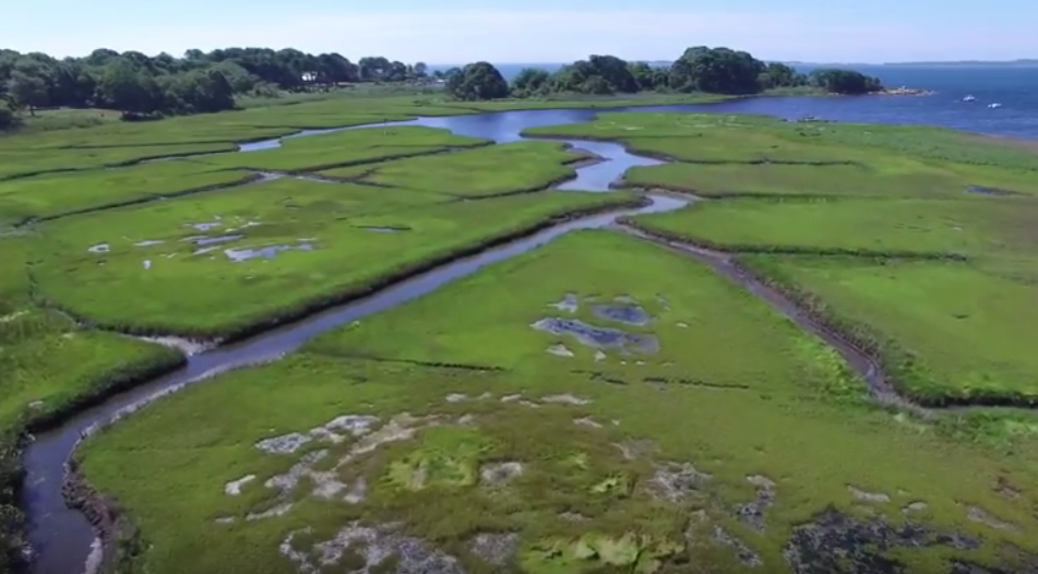
Enter technology: The Drone. Together with Stonington resident and member, David Young, we are working on ways to view some of our properties from the air. The first is the salt marsh that lies between Lord’s Point and Wamphaussuc Point, a large portion of which is protected by Avalonia Land Conservancy as the Woolworth-Porter Marsh.
This video is the first, of hopefully many, as we learn to fine tune the technology and techniques needed to accurately view our properties, assess where we may need to go in on foot for closer inspection, and to keep a record of changes over time to one of our most fragile coastal assets: the salt marsh.